
I never planned to walk the Hebridean Way. It was pure luck that, while travelling through Scotland, I happened to come across a guidebook about it. I lost myself in its pages almost immediately – and found the perfect way to continue my journey.
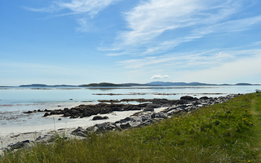
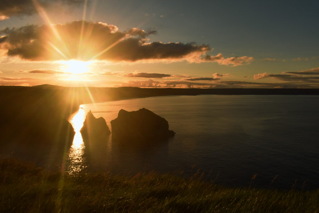
The Hebridean Way is a 252 km hiking trail that winds its way across the ten main islands of the Outer Hebrides, off Scotland’s west coast. It’s unlike any trail I’d walked before, offering incredibly diverse landscapes—from Caribbean-like beaches to vast moorlands and mystical mountains. Despite passing through small villages, the trail always carried a sense of remoteness and adventure. Along the way, I encountered a multitude of wild animals, vibrant flora, and some of the kindest people I’ve ever met.
In this post, I’ll share my experience on the trail, what I wish I’d known before setting off, and the tips and insights that can help you plan your own unforgettable journey.

The Trail at a Glance
The Hebridean Way is an official hiking trail established in 2017 by Scottish Natural Heritage and maintained by the Outer Hebrides Tourism Board, running from Vatersay in the south to the Butt of Lewis in the North. Walking it you’ll cross ten breathtaking and unique islands and walk a total of 252 km through diverse terrain. Most of the trail follows remote hiking trails, however there are some stretches along quiet roads. To get from one island to another, you’ll cross six causeways and take two ferries. This poses some logistical challenges to coordinate with ferry timetables but also gives you time to rest and enjoy the view.
Key Facts
- Length & Duration: 252 km, 10-14 days depending on pace and weather
- Direction: official recommendation is south to north because of the wind direction
- Navigation: well-marked, GPS is still suggested
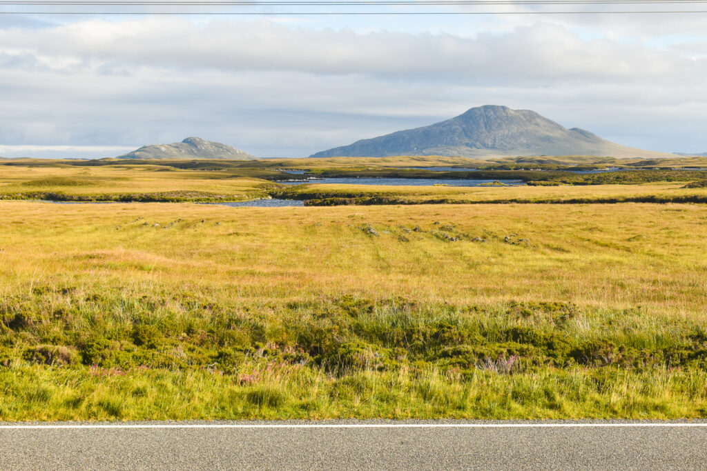
- Terrain: great variety, sand beaches, open moorland, rugged mountain paths, paved and gravel roads
- Season: possible April-October, late spring or early summer recommended (long daylight, mild weather and fewer midges)
- Accommodation: (wild) camping, hostels, hotels, B&Bs, cottages. Possible but not recommended without a tent, wild camping is legally allowed following the guidelines
- Food & Resupply: only few shops with limited supply on trail, plan ahead where and if you need to resupply
- Ferries: 2 ferry trips necessary on trail, no booking required for foot passengers
- Weather: All-season weather – you might get sun, wind and rain all within an hour. Most days shift between mild sunshine and light rain, but anything is possible! Always stay updated on forecasts and weather warnings.
- How to get there: Ferries run to the southern islands from Oban and Malaig and to the north from Ullapool. The Isle of Skye (Uig) also connects to the middle of the route.

Planning your Hebridean Way Adventure
If you’re anything like me, you might find yourself on this trail quite spontaneously and with barely any planning beforehand. While that’s definitely possible, I wouldn’t really recommend it. A bit of preparation can go a long way in making your hike more enjoyable – and a lot less stressful. Here are a few things I wish I’d thought about before I set off.
How to get there?
The Hebridean Way stretches across the Outer Hebrides, an archipelago off the Scotland’s rugged west coast. Getting there can be a bit of a hassle, as you’ll need to cross over to the islands by ferry. There are two main travel routes: one via Glasgow and the other one via Inverness. Each route has its own pros and cons depending on where you’re coming from, how much time you have and whether you plan on extending your trip further.
Going via Glasgow
This route has three main advantages:
- It’s located further south, making it easier to reach from much of the UK (look up train and driving time from London).
- It has a well-connected airport and train station (look up whether Inverness has one)
- It connects to the harbour closest to the southern trailhead, which is where you will most likely start your hike
Sample Itinerary:
- Day 1: London -> Glasgow (National Rail or Caledonian Sleeper, 4.5h-7.5h)
- Day 2 Morning: Glasgow -> Oban (Scotrail, 3h)
- Day 2 Afternoon: Oban to Castlebay, Barra (Calmac ferry, 5h)
- Day 3: Bus to trail head in Vatersay
By train to Glasgow: Taking the train from London can be a lovely start in your journey, as it allows you to watch the countryside gradually shift from urban landscapes to lush meadows to mysterious mountains. You can chose between two options:
- National Rail day trains from London Euston: 4.5-6h, £50-200
- Caledonian Sleeper night train: 7.5h, £50-380 (seat, sleeping berth or en-suite)
Tip: Even though it’s a night train, regular seats on the Caledonian Sleeper can sometimes be cheaper than day trains – and you get the unique experience of sleeping on a train (even if it’s not the most comfortable). This train also connects conveniently to the morning train to Oban. Alternatively, you could spend a day in Glasgow, to explore the city before heading off into the wild.
From Glasgow to Oban:
From Glasgow, you can take a direct train to Oban (about 3h, approx. £35). Check the ferry timetable in advance as Calmac usually indicates which trains connect with their daily trips to Castlebay. From the train station, you can hop right over to the harbour, as they’re only 50m apart.
Alternatively, you can drive to Oban yourself—it’s about 2.5 hours from Glasgow by car. Long-stay parking is available near the ferry terminal, and it’s a good idea to leave your vehicle there during the hike.
Ferry from Oban to Barra:
This ferry usually runs once a day and takes around 5 hours. While it is possible for foot passengers to buy tickets at the harbour or onboard the ferry, booking a bit in advance is still a good idea.
Castelbay is small but very charming and as you’ll probably arrive late, consider pre-booking your accommodation for your first night on the Hebrides. I once ended up pitching my tent next to a walking path near the harbour, which honestly was far from ideal, but still had a nice view of the name-giving castle.
Going via Inverness
For those starting from the Scottish Highlands or planning to explore them beforehand, this route might be especially appealing. Compared to the route via Glasgow, it offers a wider range of options and could suit adventurous travellers looking to extend their trip and visit iconic Loch Ness or the misty Isle of Skye.
By train to Inverness:
From London, you again have the two options of going on a day train or on the Caledonian Sleeper. Since this is a long journey of at least 8h, I’d recommend taking the sleeper. A standard seat can also be more budget friendly than a regular day train ticket. From Edinburgh, the trip is much shorter and cheaper, taking just 3.5-4 hours.
Ferry Options:
From Inverness, you’ll need to decide which harbour to head for. Both are accessible to reach by public transport, but you might also consider hitchhiking or driving yourself and leaving your car at the harbour parking lot.
Ullapool – Stornoway, Isle of Lewis: This route drops you near the northern end of the Hebridean Way in the islands’ largest town. It’s especially practical if you’re walking southbound or when planning your return journey.
Uig, Isle of Skye – Lochmaddy, North Uist: With its dramatic and magical landscapes, the Isle of Skye is a destination in its own right. Spending a few days there is absolutely worth it, however the main tourist areas can get overcrowded during the summer. The ferry from Uig drops you off right in the middle of the Hebridean Way, so you’ll need an extra day to get to your starting point. This is the route I took, as I first hiked part of the Skye Trail before heading to the Outer Hebrides. Keep in mind that public transport on Skye is limited, and it’s a long, long way from Uig to the nearest train station.
Public Transport on the Islands
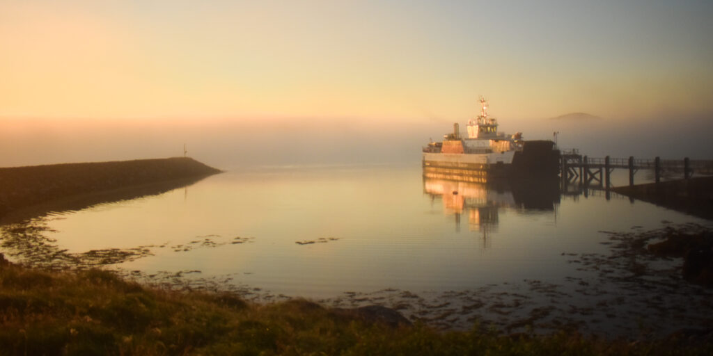
When you’ve made it to the Outer Hebrides, you’ve likely already met CalMac Ferries. The same company runs the inter-island connections, and there are two ferry crossings you’ll need to take while hiking the Hebridean Way: from Ardmhor on Barra to Eriskay, and from Berneray to Leverburgh on Harris.
One of the things I struggled most with on my trip was getting around the islands. Because I hadn’t done much planning in advance, I often found myself juggling bus and ferry timetables spontaneously, often missing a valuable connection by just a few minutes. This led to quite a bit of stress when I simply wanted to enjoy the hike. So, here’s what you need to know to move around the Outer Hebrides smoothly and without the last-minute scramble.
Ferries
Ardmhor – Eriskay
If you arrived via Castlebay and began your hike in the south at Vatersay, you’ll reach Ardmhor at the end of your first or early on your second day. This is where you’ll catch the first ferry of the trail. Though it’s a small and less-frequented crossing, it usually runs five times a day. The last ferry tends to leave around 5 pm so it’s easy to miss.
When I hiked down the hill towards the harbour, I saw the boat from the trail and rushed downhill, even hitchhiking to make it in time, only to miss the boat by a few minutes. That small miscalculation meant I had to camp beside the harbour, which offered great views, but still felt a bit uncomfortable and exposed. So, plan ahead and consider setting up camp before descending from the hills.
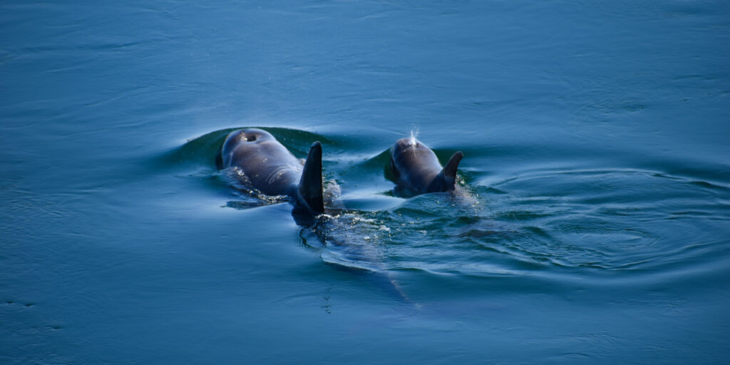
At only 40 minutes, the crossing itself is short but scenic and with some luck, you might even spot dolphins or seals along the way. From Eriskay harbour, the trail continues directly on the beach, which offers amazing camping spots.
Berneray – Leverburgh
Roughly halfway through your hike, after walking across the long causeway connecting North Uist to the small island of Berneray, you’ll come to the second ferry section of the Hebridean Way. This also marks the transition from the flatter southern islands to the rugged hills of Harris. Depending on the day of the week, this ferry runs 3 to 5 times per day with the last departure being at around 5pm, and takes one hour to cross. Make sure to schedule in some time to explore Berneray, as it would be a pity to only walk the stretch of road connecting the causeway to the harbour. The small island offers a small shop and bistro, a seal viewing spot in the middle of the main village and wild sand-dune beaches all within walking distance of the harbour.
While the ferry navigates towards Leverburgh, you get some nice views of the multitude of small islands making up the Sound of Harris. When on your way out of the harbour, you might want to consider stopping by Butty Bus, a great food truck offering burgers, panini and fish&chips. It’s always lovely to get your fingers on some fast food as a tired and hungry adventurer! From there, you might want to consider stocking up in a shop, before heading towards the beautiful hills and beaches Harris has to offer.
General Tips for the ferries
- Always check the latest timetables on the CalMac website or on the app and be aware that short-time changes and delays are always possible due to weather conditions.
- No need to book in advance as a foot passenger, tickets can be bought onboard by card.
- Aim to arrive at least 20 minutes early to board without stress.
- Most harbours have a small waiting hut with shelter, toilets, and often even power outlets. These usually lock automatically in the evening, so don’t forget your gear inside (yes, speaking from experience).
- The Ardmhor harbour has a small café, but it keeps limited hours and might be closed when you arrive.
Bus Transport
Getting around without a car on a remote island can be tricky. Luckily, the public bus system on the Outer Hebrides is surprisingly extensive and welcoming to hikers. With a bit of planning (and a tolerance for some of its quirks), it can make your journey much easier. For me, the buses were essential for enjoying the trail: they helped me save time and energy getting to the trailhead, taking detours and staying flexible when a ferry was cancelled. And they incidentally led to some of my favourite trail memories thanks to the lovely drivers and passengers I met along the way.
When and why you might use the bus:
- To get to the trailhead: Whether you start in the north or south, you’ll most likely nee a bus to reach the trailhead. To get to Vatersay, there is a direct bus from Castlebay Pier.
- To reach your accommodation: In most instances, you’ll need to take a short detour from the trail to find an actual bed instead of a wild camp spot. If you decide to rely fully on pre-booked accommodation, you’ll need to take the bus nearly every day.
- To do detours: There are some sites on the Outer Hebrides that you risk missing out on by just walking. One example is the Callanish Stones, a fascinating cultural site well worth the additional bus trip.
- To stay flexible: Sometimes plans need to change and the bus system can be a lifesaver, allowing you to spontaneously resupply, find shelter, get medical aid or simply skip a section of the trail.
Tips for using the buses like a local:
- Check current timetables: The best source for is the council website: https://www.cne-siar.gov.uk/roads-and-travel/bus-services. Timetables can look confusing at first, with various symbols for holidays and exceptions, so make sure you take your time to get familiar with them.
- No service on Sunday: Buses run Monday to Saturday only, with absolutely no service on Sundays. Definitely something you need to keep in mind while planning!
- Advance booking: Timetables will also indicate in what instances you need to book your bus ahead of time. Sometimes, you’ll need to flag down the bus at your stop or from the roadside to get picked up.
- Good ferry connections: Bus schedules are well-coordinated with ferry times. Drivers will even often wait for delayed ferries.
- You’re on a public bus: These are not tourist shuttles, and you will be sharing the bus with locals, so act responsibly and don’t expect extra treatment. I once ended up on a small school bus which connected to a bigger school bus, stopped at the local school to let out 30 school kids and only then took me to my actual destination.
- Drivers are very helpful: Every bus driver I met was incredibly friendly and made sure to answer every question with great attention to detail. One even suggested a camp spot and later helped return a lost water bottle. The locals know the islands inside out and are happy to chat and share their knowledge.
All in all, I found that the buses I took while on the Outer Hebrides didn’t just connect me to my destinations, they connected me with the people and their stories, offering a glimpse into their daily life that I couldn’t have experienced otherwise.
Hitchhiking
While public transport covers most needs on the Hebridean Way, there may still be times when no bus runs, the schedule doesn’t fit your plans, or you find yourself suddenly stuck in the middle of nowhere. In these cases, hitchhiking can be an incredibly helpful tool to get around. It’s not uncommon on the islands, and locals are often kind and willing to help hikers out.
How to increase your chances:
- Pick a good spot: If drivers don’t feel safe enough to stop, even the kindest people won’t pull over. Look for a bus stop, side lane or slow-moving traffic where cars can stop without risk. Make sure drivers can see you early enough and that it’s clear in which direction you’re heading. Don’t try walking and hitchhiking at the same time (as tempting as it may be) as this will makes things more dangerous for everyone involved!
- Research your route: Know where you need to go and figure out which road drivers are most likely to take. Set yourself up for success at the right exit of a junction exit or walk to a spot that covers multiple routes. When somebody stops, make sure you know whether that small village they mention is in the right direction or if you’re better off waiting for another ride.
- Look like a hiker: Drivers are often more afraid of hitchhikers than you are of them. Make your intentions clear from miles away. Have your backpack and trekking poles clearly visible, and your thumb out well before cars reach you.
- Be patient and stay happy: Traffic on the islands can be sparse, and you might wait a long time for a single car to pass. If that one car simply drives by, frustration can hit. Keep yourself entertained: start singing, dancing, skip stones – whatever keeps you in that happy place. Happy, smiling hikers are far more likely to be picked up than grumpy-looking ones.
- Be polite: When you’ve finally been picked up, you might already be exhausted and struggling to keep your spirits up. Hitchhiking however is a two-way street, and usually expect a a bit of human interaction, even if it’s just a thank you and a story to tell their friends. So get ready for some small talk and to share your big adventure. Think of leaving a good impression as a long-term service to future hitchhikers!
How to stay safe:
- Trust your gut: If a ride doesn’t feel right, don’t get in. If simply saying no feels unsafe, just tell them it’s not your direction or that you’re waiting for someone going further!
- Let someone know your plans: Send a quick message to a friend or family member with your location and intended destination and keep them updated.
- Keep your phone close: Don’t let your phone disappear into the trunk with your backpack and always keep it on you. The right drivers won’t mind you holding it, sending a safety message or checking your map during the ride.
- Talk before you get in: Always speak to the driver first. Confirm their route, your drop-off point and get a general feel for the situation. Don’t let anyone rush you into the car no matter the circumstances.
- Be aware of your surroundings: When I hitchhike, I always keep a map open on my phone. This keeps me oriented, gives me reassurance that I am still on the correct route and helps me stay vocal about where I need to go. Sometimes even locals don’t know the best routes for hitchhikers and it is okay to tell them to drop you off if they diverge from your originally planned route.
- Stay visible: When waiting, wear your brightest clothes, use a headlamp at dusk and wait well off the road if possible. You want to get a ride – not get run over.
Hitchhiking can be intimidating at first, especially if you’re travelling solo, but it adds spontaneity and a sense of adventure and lets you meet some truly awesome people in unexpected ways. I found it to be a surprisingly reliable option of getting around the islands and it was quite fun to get to know some of the locals on their daily drives to work.
Accommodation
When I was standing on the ferry, about to arrive on the Hebrides for the first time, I was unsure what to expect. But with my trusted camp gear in the backpack and a good understanding of the Scottish Outdoor Access Code, I knew I’d at least have one thing covered: I wouldn’t have to worry about booking accommodation.
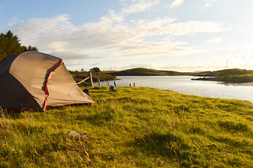
Wild Camping
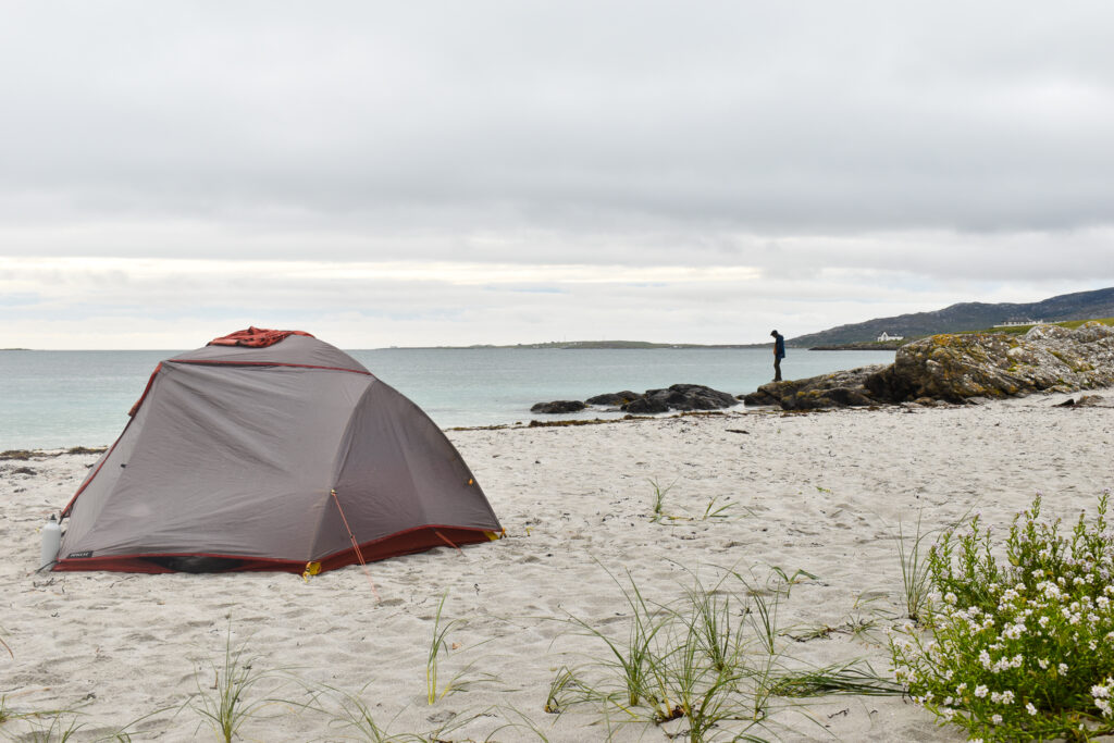
Thanks to Scotland’s extensive right to roam, the Hebridean Way offers one of the rare opportunities in Europe where wild camping is completely legal. Still, there are a few things to keep in mind to make the most out of your stay and camp responsibly:
- Follow the Code – Camp well away from buildings and roads, avoid crop fields and farm animals, leave no trace and don’t light open fires. You can find more information on the official guidelines at: www.outdooraccess-scotland.scot
- Weather – It’s not just a myth that Scotland is rainy. Make sure you have quality waterproof gear and a reliable sleep system with a comfort limit lower than you expect to need. I also always carry a small emergency blanket with me just in case.
- Fresh Water – With most of the trail being close to either the ocean or farmland, good water sources aren’t always easy to come by. I didn’t carry a filter and managed fine, although I did have to ask a local to use their garden hose once.
- Camp Spots – Being able to camp anywhere sounds great, until you realize you’re in the middle of endless moorland with no dry spot to be found. While there are plenty amazing tent spots all along the trail, be aware that on some sections you might have to walk a few kilometres extra to find something suitable.
- Be respectful – Most locals are very friendly and far more tolerant of hikers and their small tents than of campervans. A few even pointed me to beautiful camp spots that I wouldn’t have found otherwise. That said, if someone asks you to move, please do. Even if you’re tired and already settled down – we want to keep the locals on our good side!
- Stay Safe – Choose your spot wisely: out of view from roads, slightly elevated to avoid pooling water, away from the tide line, sheltered from the wind, and with firm, flat ground. If something feels off, text someone your location.
…and its Alternatives
While the Hebridean Way is perfect for wild camping, there are of course other options as well. These require a bit more planning but might be worth the comfort of a good night’s sleep. Here’s what to keep in mind:
- Campsites – A couple of campsites are scattered across the islands but most are designed with motorhomes in mind. You won’t be able to rely on them exclusively, but they are a good alternative for in between.
- Stornoway Area – Being the capital of Harris and Lewis, Stornoway boasts an impressive 6.000 inhabitants. Wild camping isn’t really possible here, so I’d recommend either pre-booking a bed or heading just outside of town to Laxdale Holiday Park, which has good facilities for tent users.
- Guesthouses & Hotels – There are plenty of B&Bs, hotels and cottages across the islands, but they can be far apart. Also make sure to book ahead, especially in peak season.
- Logistics – Walking the trail without a tent is possible but it definitely makes planning more complicated. Most accommodation is a bit off-trail, so you’ll need to factor in bus timetables or extra walking to get there.
For more detailed information, you can look up the official website visitouterhebrides.co.uk, where you’ll find a good accommodation overview and a map of all the campsites.
Challenges on Trail
Being as remote and wild as it is, the Hebridean Way definitely comes with its own unique challenges. Apart from all of the logistics already mentioned above, here is what you need to be prepared for:
Resupply:
The only supermarkets directly on trail can be found in Creagorry (big Co-op that you walk right past), Tarbert (A D Munro, very limited supplies and closed on Sundays) and Stornoway (multiple stores, but especially a big Coop closeby, also closed on Sundays). There are, of course, other stores that require a detour to reach. The best food strategy would be to take most of your supplies with you and only head for the shops and cafés along the way for snacks and added variety. If you have pre-booked accommodation, you might also be able to arrange sending yourself resupply boxes or getting lunch packages.
Weather:
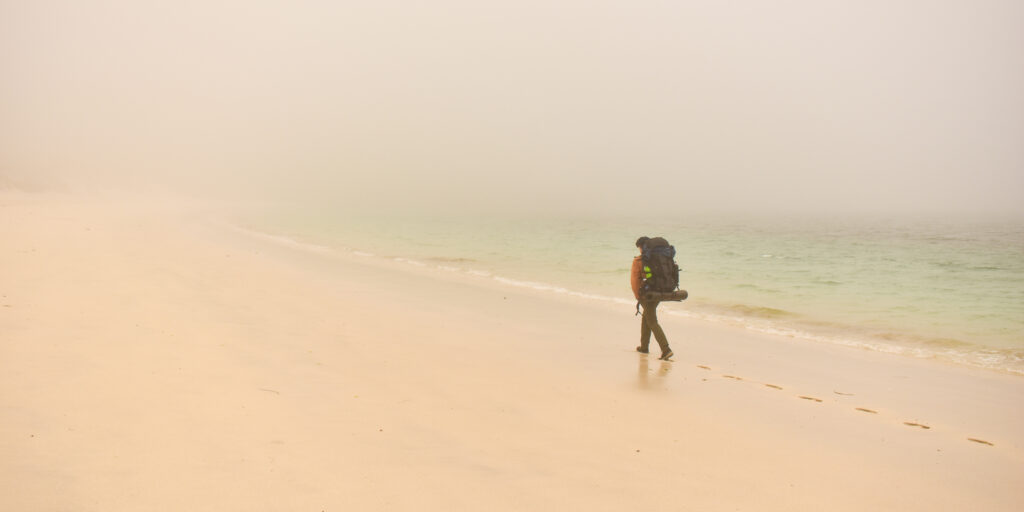
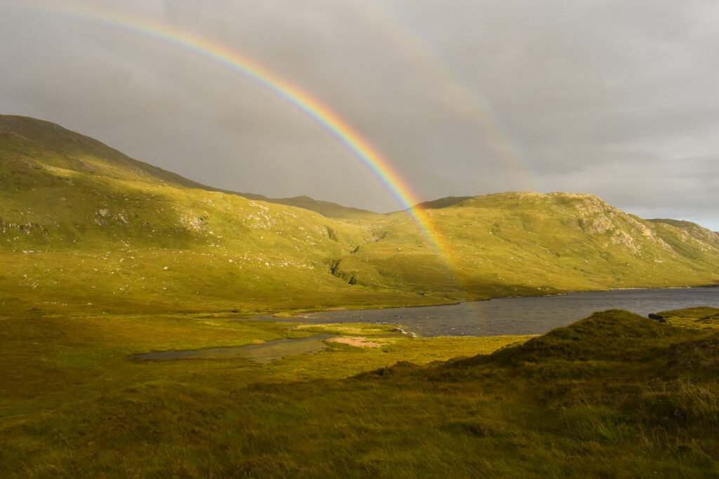
Yes, I have mentioned the weather challenges before, but with about 21 rainy days per month, it is worth mentioning again. Temperatures can drop quickly and walking in fog becomes quite a habit after a few days on the trail. The always changing weather will provide you with lovely summer sunshine and quite a few rainbows in between as well though! Strong winds are also common and can make a big difference in perceived temperature, walking pace and of course comfort. In my case, they even tried to blow my tent away once…
Trail Navigation:
I am exceptionally talented at getting lost and even I managed to stay on trail, even in foggy conditions. That said, the small waymarkers can easily be missed and the path isn’t always obvious. Make sure you either have a good guidebook, paper map or trail map downloaded to be on the safe side.
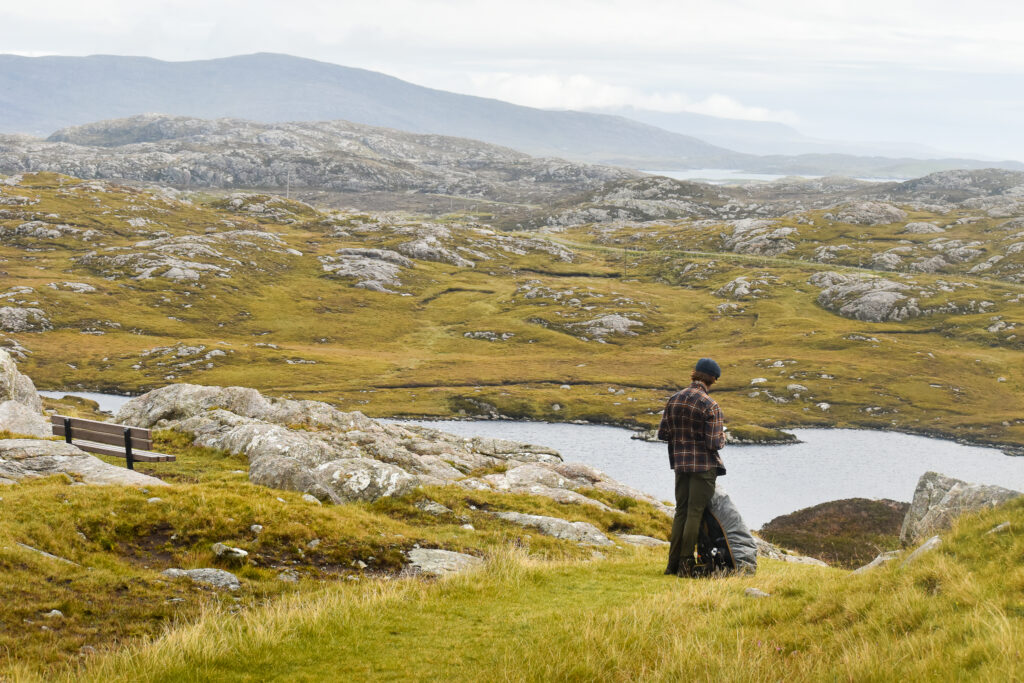
Terrain:
One of the trail’s best features is also one of its major downsides and that is its variety in landscapes and therefore the terrain you’ll walk on. Sandy beaches, muddy tr and soggy moor paths all provide their unique difficulties. The road walking especially on the causeways can also be draining and make you really feel those tired feet. Daily ascents however are rather manageable, with only Barra and Harris having some steeper sections that will get your legs burning.
Midges:
These pesky insects definitely deserve their very own warning paragraph. They are everywhere you don’t want them to be, have a nasty bite and can ruin even the most beautiful sunset. Take insect repellent and a head net, especially when you’re camping as midges mostly come out around dusk. To avoid them, set up your tent in a slightly windy spot and get inside as soon as possible. Still, expect a few of midges to sneak in and try to bite you while you sleep.
Why it’s Worth it
Of all the trails I’ve walked so far, the Hebridean Way holds a special place in my heart. Something about these islands in the middle of nowhere touched me in a way I could have never predicted. Maybe it was the ever-changing views, the calm mornings, the glistening fields, or the sheer wonder of actually getting to know a place by walking through it. Even though it’s hard to put into words, I have tried to find a few points that stood out for me:
The Landscape:
Every island has its very own distinctive features and because you’re walking through, you get to see the landscapes shift around you, each telling their own story. On trail, every day offers a new perspective and at every corner you’re surprised by the pure beauty of this region.
The Wilderness:
It’s a rare feat to find a place that keeps the balance between civilisation and wilderness but the Hebrides seem to manage well. One moment, you’re walking past a small farm, the next you’re all alone in the rugged mountains, seemingly miles off from any human beings. Being this close to nature, you’ll be able to spot wild animals like seals, red deer, and a wide range of seabirds and birds of prey all around you. If you’re lucky, you might even catch a glimpse of the occasional golden eagle or dolphins swimming near the causeways.
The Trail:
For a relatively new and unknown trail, it is astonishingly well thought out. Yes, there are some annoying road sections and the ferry logistics can add a bit of unnecessary stress, but overall the route offers a great variety of terrain and a very pleasant experience. With relatively flat terrain and regularly passing villages, it is surprisingly beginner-friendly for a two-week trek. The tracks and waymarkers are actively being looked after, and there are regular updates on the trail’s website in case of diversions.
The People:
Rarely have I felt this welcome as a hiker. From a friendly smile as you pass to grand gestures like offering tea or a ride as you just walk by, the locals often show exceptional kindness. Some of my favourite trail moments come from the small conversations while passing by and all times I felt like I could get a glimpse into life on the Hebrides through its people.
The Adventure:
While you are never actually far away from the next house, this trail offers a unique sense of adventure without adding too many dangerous elements. The harsh mountains, vast moorlands, high sand dunes and tough weather for sure make you feel like a proper adventurer. Combine this with carrying a heavy backpack and wild camping on the beach and you’ve got some epic stories to tell once you’re through!
In the end, the Hebridean Way is a trail that will challenge, surprise and definitely change you – just like all great adventures do.


Useful Links
- Official Tourism Website: www.visitouterhebrides.co.uk
- Outdoor Access Code: www.outdooraccess-scotland.scot/
- Ferries: www.calmac.co.uk
- Trains: www.travelinescotland.com
- Trail Overview and GPS tracks: www.walkhighlands.co.uk/outer-hebrides/hebridean-way.shtml
- Guide book: https://www.cicerone.co.uk/the-hebridean-way
- Detailed weather forecast: http://hebweather.net/